One man has died after being swept away by floodwaters in Queensland and a "mini-tornado" destroying several homes in New South Wales as extreme weather fronts wreak havoc on several across Australia.
In souther Queensland, a man was killed near Bundaberg after his car was washed away by floodwaters. Moments earlier, he had let his brother out to check on water levels. Swiftwater rescue crews in the region rescued several other people, including a woman and her children, and a man who had abandoned his car and was found clinging to a tree.
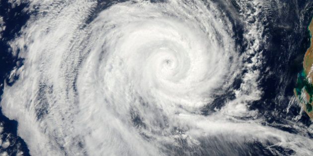
In Western Australia, tropical cyclone Stan is threatening lives and homes in the Pilbara region after making landfall on Sunday morning.
WA's Department of Fire and Emergency Services (DFES) said a red alert -- the highest possible -- was current for people between "Port Hedland and Wallal extending inland to Marble Bar and including Pardoo, Wallal, Eighty Mile and Marble Bar". The alert does not include Port Hedland or South Hedland.
"There is a threat to lives and homes. You are in danger and need to act immediately," DFES said on its website.
Stan hit the coast just east of Pardoo as a category two cyclone early on Sunday after earlier forecasts suggested it would intensify into a category 3 system.
The Bureau of Meteorology (BoM) said there were sustained winds near Stan's centre of 100 kilometres per hour with wind gusts to 140km/h. It's moving south southeast at 20 km/h.
The cyclone is forecast to weaken as it moves inland onSunday.
"Gales with gusts to 100 km/h are likely to be occurring in coastal and adjacent inland parts between Bidyadanga and Port Hedland, increasing to potentially destructive winds with gusts to 150 kilometres per hour near the centre of the cyclone," BoM said.
"Gales with gusts to 100 kilometres per hour are likely to extend to the inland east Pilbara and adjacent Interior districts during Sunday as Stan continues to move towards the southeast and increase in speed."
BoM warned residents in areas between Pardoo and Bidyadanga of the potential of a very dangerous storm tide due to the cyclone.
"Tides are likely to rise significantly above the normal high tide mark with damaging waves and very dangerous flooding. As the cyclone moves inland over the next few hours the storm tide risk will ease," BoM added.
According to Sky News, Stan is the first cyclone of the Australian season, which started on November 1 last year.
A lower level alert is in place for coastal communities from Wallal to Bidyadanga, but not including Bidyadanga, and also between Marble Bar and Jigalong including Nullagine, Roy Hill and Telfer but not including Jigalong.
"(People) need to take action and get ready to shelter from a cyclone," BoM said.
An evacuation centre has been set up at the JD Hardie Centre in South Hedland.
Meanwhile, in south-east NSW, destructive winds during thunderstorms destroyed several homes at Forbes Creek, about an hour east of Canberra.
The Hoskingtown-Rossi Rural Fire Brigade (RFS) said a "mini-tornado" hit the town, however a Bureau of Meteorology (BOM) forecaster was unable to confirm any tornado activity in the area.