Drones, or Unmanned Aerial Vehicles (UAVs) as they are more formally known, are rapidly increasing in popularity and their purposes seem to be forever evolving.
No longer is their use strictly limited to surveillance in war zones. They are also frequently used in land surveys, real estate, agriculture and by users who capture breathtaking aerial photographs and videos.
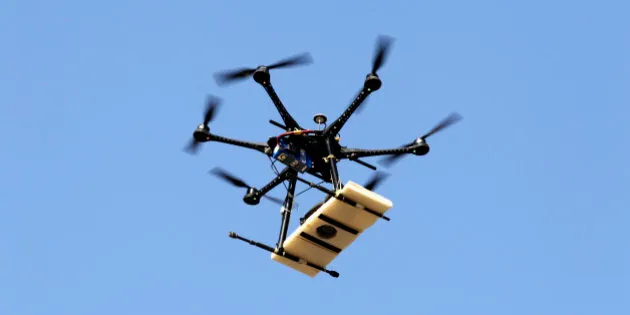
Even Australia Post is trialling the use of remotely piloted drones to deliver parcels to customers.

Australia Post is expecting to start customer trials using drone delivery later this year.
However, an increase in drone traffic also means a higher risk of drone collisions, not only with other drones but also obstacles in the built environment.
Last week, a British Airways flight was struck by a drone as it came in to land at Heathrow Airport.
The plane landed safely but the incident highlighted the “very real dangers of reckless, negligent and sometimes malicious use of drones”, according to Chief Superintendent Martin Hendy of the Metropolitan Police Service’s Aviation Policing Command.
Dr Stefan Hrabar from the CSIRO specialises in research on UAVs and is currently part of a team that is developing algorithms that will keep them safe and free from collisions through a device known as Hovermap.
The new technology involves a rotating laser that is used to give a full spherical view around a UAV while it is moving.
“Twice a second it builds up a local map, like a safety bubble,” Hrabar told The Huffington Post Australia.
“The map in real time is taking a local snapshot as the laser rotates and generates what the greatest threat is in that local area. This can be used to keep a UAV safe, it will push back if a pilot gets too close to an obstacle.”

Hovermap technology will keep drones from colliding with structures through laser mapping.
Hrabar also pointed out that the algorithm used to generate the map doesn’t require GPS, meaning that the Hovermap can be used underground and close to structures that block GPS signals.
A built-in logging computer also logs the information to a USB stick while the UAV is in flight so that it can be later uploaded to servers for processing and produce comprehensive maps of complex vertical structures or even crime scenes.
Peter Gibson, corporate communication manager of the Civil Aviation Safety Authority (CASA) believes that the technology will be a game changer.
“Drones, or remotely piloted aircrafts, are now their own sector [within the aviation industry] and it’s a sector that is growing rapidly,” he told HuffPost Australia.
“Anti-collision technology will be one of the real steps forward, once available. For commercial drones, you will have the possibility of being able to operate them in built up areas for parcel delivery.
“Current technology just doesn’t allow that because they don’t have the ability to sense what is around them and avoid it.”
Hrabar said that the collision avoidance sensor will have great potential in the use of UAVs in the commercial sector.
“We are doing something that is unique in the world with the laser mapping.”