It snowed in the Victorian Alps and NSW Snowy Mountains on Sunday night. A lot.
This surprised pretty much no one in the mountains. Locals were well prepared for an early wintry blast, as you can see from this thread on the leading industry website ski.com.au. Yep, they knew it was comin'.
The cold front moved through Melbourne early Sunday morning, dropping the temperature from 16 degrees at 8:30am to 11 degrees at 9am. Temps hovered in the low teens thereafter, on a thoroughly miserable Sunday.
The blizzard started around lunchtime in the Victorian Alps. This footage was shot at Mt Buller.
By midnight or so, there was already about 15cm of snow on the ground at Buller.

The cold front roared into Sydney around 6pm. Flights were delayed for an hour or so, and Sydneysiders in general expressed great surprise at the first cold air of the year -- despite the fact it had been on the forecast for a week. So Sydney.
Down in the NSW Snowy Mountains, the ski resorts also received their first snow of the autumn. Initially they didn't receive as much snow as in Victoria, but the blizzard is intensifying Monday morning as the main blob of moisture in this weather system tracks northwards.


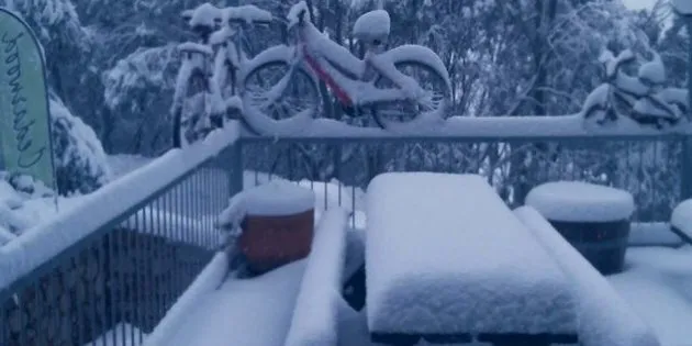
Meanwhile, 10-15cm of snow seemed to be about the total for most of the Victorian ski resorts.
And the kids wasted no time making snowballs out of the pristine snow that fell on the outdoor table at Cedarwood Lodge in Falls Creek.

This is early but not crazy early for a snowfall of this magnitude. The snow will likely melt within a few days, so if you feel like a bit of skiing or snowboarding, you'll likely have to wait until the official season opening on June 10.
Meanwhile, cool temps will stick around for much of the week for the southern capitals.
ALSO ON HUFFPOST AUSTRALIA